


Medieval Map of Idaho with Cities and Landmarks
Prompt
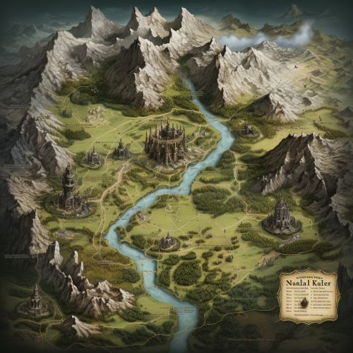
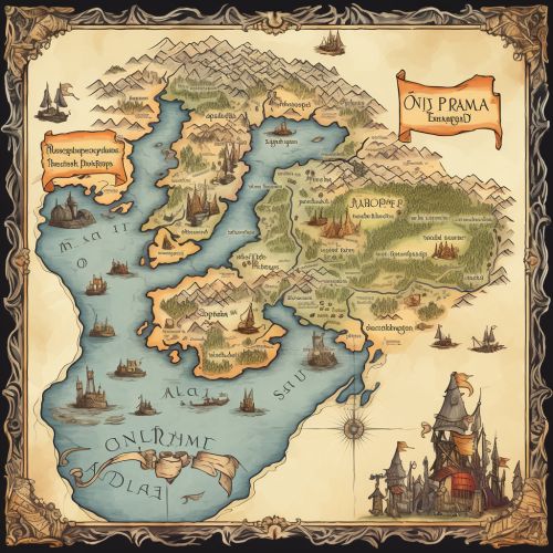
Map of the United States State of Idaho, drawn in the style of medieval maps. Including the cities of "Coeur d' Alene" "Moscow" "Lewiston" "Boisie" and "Ketchum"


 Download Image (SD)
 Download Image (HD)
Share


License
Free to use with a link to 2moonsai.com

Similar Images
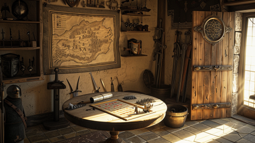
Medieval headquarters with a dashboard on the wall showing a medieval map of France, one round table in the center of the room with scroll paper and a gameboard with knights figurines, one sword lying on the table, some swords and armor in shelves and a door with light entering the room through it --no people --ar 16:9

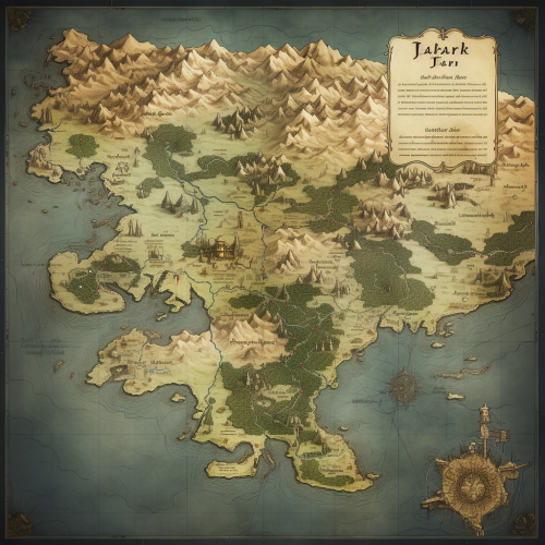
***an etching of an early world map, in black and white, shot from above, aerial view, in a basic not to elaborate style, roughly sketched, with a route that goes through different landscapes, on it : a village, a forest, a bridge, mountains, a valley, a dragon, a holy grail, highly detailed, medieval, inspired by the maps of game of thrones and lord of the rings


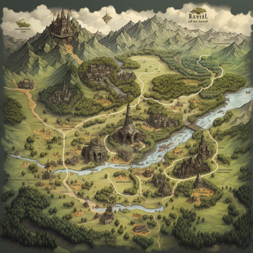
travel card, technomancy of medieval city map, with themes of astronomy, a coat of arms, crescent moon, whimsical galley, cartoon by albrecht durer, edward hopper, vermeer, and miro and colours by miyazaki --ar 17:11 --no faces --v 5.0
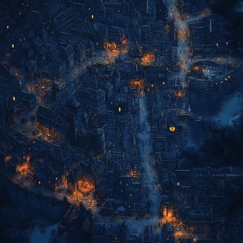
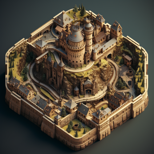
a map of a large, dense, medieval city for a dnd campaign. It should look dark and foreboding. Use plenty of dark blue colours with sporadic amounts of Amber to illuminate the streets.
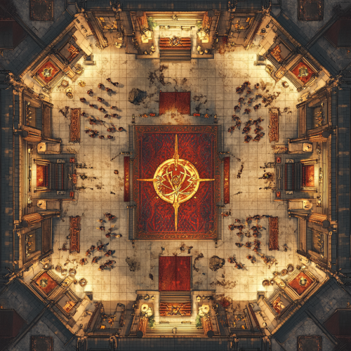
a top-down tactical map of a grand Great Hall within a medieval guild, measuring 200 feet long by 100 feet wide. The hall should include a 10-foot-wide gallery walk that encircles the entire space, elevated above the main floor. The main area features a detailed mosaic of the guild's sigil at its center, surrounded by vaulted ceiling structures, suggested through architectural layout cues. Include large, ominous glowing crystals strategically placed around the perimeter. Additionally, depict several figures bound in magical restraints, forming a ritualistic pattern in the center of the hall. Guild members are shown moving between these figures and interacting with the environment. The map should contain a 1 inch equals 5 feet grid, suitable for tactical gameplay in tabletop RPGs. Elements like ornate columns, stained glass windows, and decorative doors should enhance the atmosphere of grandeur mixed with a sense of dark energy. This visualization should convey both the scale and the intricate details necessary for a complex RPG encounter.

flat outline of the state of Idaho filled with the Idaho state flag --ar 1:1
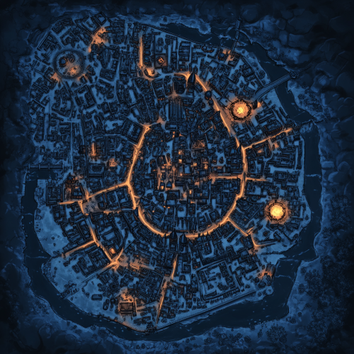
a map of a large dark medieval city for a dnd campaign. Use dark blue colours for most of the map to emphasise a moody scary tone. Sporadic spots of Amber light help define the roads.
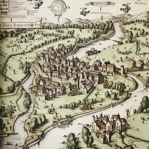
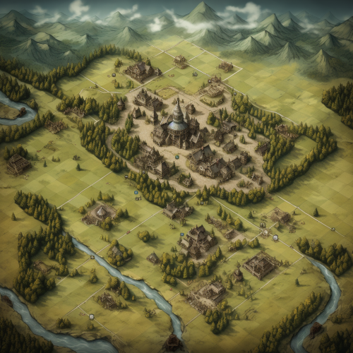
top down lithograph map of small medieval farming village on a river --style raw

View Limit Reached
Upgrade for premium prompts, full browsing, unlimited bookmarks, and more.
Get Premium
Limit Reached
Upgrade for premium prompts, full browsing, unlimited bookmarks, and more. Create up to 2000 AI images and download up to 3000 monthly
Get Premium
Become a member
Sign up to download HD images, copy & bookmark prompts.
It's absolutely FREE
 Login or Signup with Google
Become a member
Sign up to download HD images, copy & bookmark prompts.
It's absolutely FREE
Login or Signup with Google
Limit Reached
Upgrade for premium prompts, full browsing, unlimited bookmarks, and more.
Get Premium